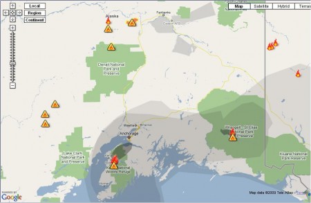
As I was biking home from work today, my lungs were burning, my eyes were squinting, and my nostrils were flaring. Was I hammering? Nope, I was inhaling the acrid smoke that has descended over Anchorage in the past few days. Our long stretch of amazingly dryweather has triggered an outbreak of forest fires around the state. It figures, the sunny skies were too good to last.
I was curious. Of all the fires around the state, which fires are actually contributing to the fact that I can’t even see the Chugach from a few miles away? Is there any hope that the winds might shift? o Or a rain shower will knock down the haze?
Before Mt. Redoubt erupted, NOAA and the Alaska Volcano Observatory had models predicting which way the ash cloud would go. And after it erupted, there were maps showing where it actually went. I thought those were really cool and useful. I thought I could find something similar for forest fire smoke.
So far, this is the best map I have found for smoke (there are plenty of maps out there if you want data on the fires themselves). You can play with the real-time interactive map here.

Be First to Comment